The feasibility study was published in August 2022 and identified three routes.
1. Kingston Road route (blue route on map)
Starting in Kingston St Mary, this route runs southwards along Taunton Road without deviation until it reaches the junction with Corkscrew Lane at the north of Taunton. This would then link into the existing signed cycle route to the town centre and NCN 3 beyond.
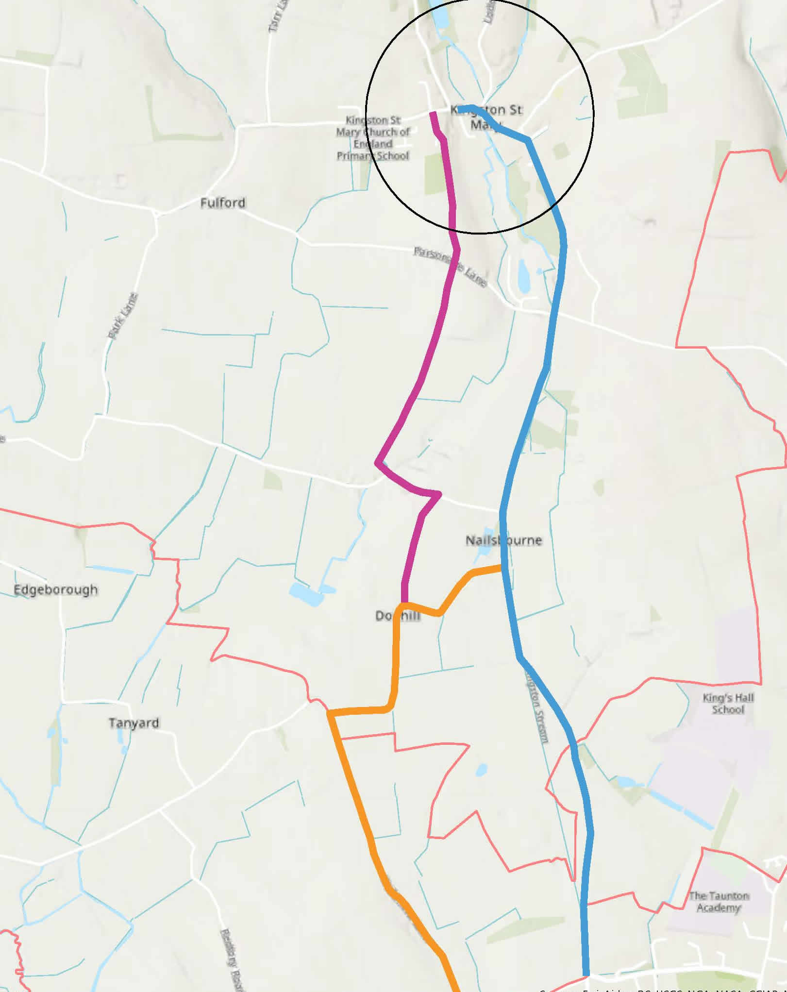 2. Right of Way route (red)
A public footpath provides an alternative option leaving Kingston St Mary to the south. This route is essentially parallel to Taunton Road until reaching Nailsbourne where it joins Nailsbourne Road. From here there is another footpath leading south towards Dodhill, where it would link with option 3, or it could continue on to Taunton Road linking with either route option south.
3. Dodhill Route (orange)
This option starts along the same route as option 1 until reaching the Dodhill junction. At this point, it turns to the west onto Dodhill Road. After a few twists and turns, this route turns south onto Whitmore Lane and continues on until reaching the start of a traffic free path at Corkscrew Lane. From here the route continues east until reaching the existing signed route into Taunton town centre.
At this stage, the most feasible, practical and pragmatic route, based on local knowledge, is a combination of the Kingston Road Route (with an off-road section between Mill Cross and Nailsbourne Lane) and the Dodhill Route.
Read the full report (PDF)